Community participation in sustainable natural resources management practices holds a crucial role. Residents' active involvement can be encouraged by familiarising them with local natural resources that are assets to the area where they live while understanding the potential of those resources and managing them sustainably.
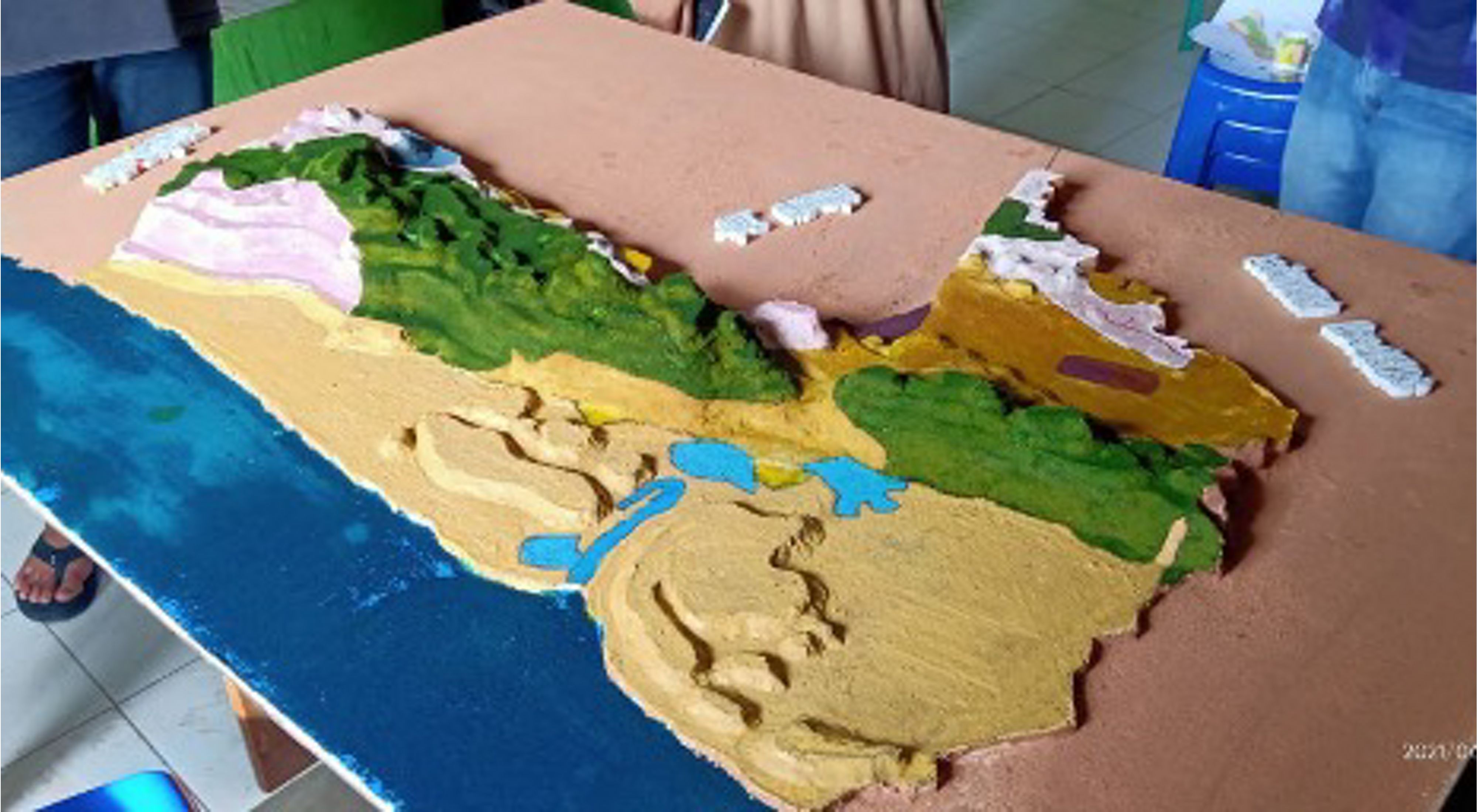
Yayasan Konservasi Alam Nusantara (YKAN), together with its partner, the Foundation for Ummah Resources Development and Improvement (YP2SU), has advocated for the construction of three-dimensional (3D) mapping in five villages in the Berau district. The 3D map products were part of the SIGAP (Inspiring Community Actions for Change) Approach Programme in villages around oil palm plantations that are part of the Low Emission Palm Oil Programme with the support of the German Federal Ministry for the Environment, Nature Conservation, and Consumer Protection (BMUV-IKI). The SIGAP Approach for the Oil Palm Plantation Sector selected the Karangan village, a hamlet in the coastal area in Berau, as one of the locations for its implementation. One of the outputs of this programme was a 3D map and a Village RTGL map.

A "3D Map" is a miniature version of the actual natural landscape. It is a source of information and knowledge for its residents on the physical state of their village and its surrounding areas. In addition, the map can be used as a resource for village development planning and drafting a Land Use Plan (RTGL).
In April 2021, YP2SU held a training on 3D map construction with participants from Karangan village, Biatan Bapinang, and Biatan Lempake. The 3D mapmaking team from Karangan village consisted of 5 people. They were the village facilitator, local facilitator, and village officials. The process took two days, from 17 to 18 April 2021, at Karangan's village hall.
With the 3D map, residents could identify their village's landscape quickly. Every resident who viewed the 3D map could point out areas with forests, hills, caves, natural springs, wooded forests that are overgrown with varieties of trees such as ulin (ironwood) and bangkirai, habitats of orangutan, proboscis monkeys, bears, and fishing grounds. In addition, they can also use the 3D map as a practical planning and mapping tool for the village. For example, the villagers can discuss plans for their forests, mangroves, and water springs.
Meanwhile, drafting a Land-Use Plan map for Karangan village began on 21 April 2021. Facilitators met with residents who knew the village's history, assets, and potential. According to them, the Karangan village was the oldest hamlet in the Biatan subdistrict, with a relatively large expanse of area. One of the challenges faced when designing the RTGL map was the confusion regarding the village's boundaries. The map they had been using diverged from the map resulting from the geo-tagging survey. Several areas were missing from their land coverage map, which they had used as a base for their 3D mapmaking. However, in the end, the villagers agreed that the land cover map used for the 3D mapmaking would serve as a basic map to represent the assets and potentials of the Karangan village.

The village of Karangan is rich in natural potential compared to other hamlets in the Biatan subdistrict. With karst, Karangan still has natural forest reserves. However, the village does not have enough land to be cultivated by its people.
During the RTGL map design discussion, residents agreed on several important points. Namely, they wanted to develop mangrove tourism by constructing a footbridge; the Karangan village has several springs that they can utilise into a clean water source and public bathing pools; also, they can turn their karst landscapes into mountain eco-tourism that can go hand-in-hand with conserving forest sustainability.


